Covington (Kentucky)
Here is general information about Covington in Kentucky
Covington statistic
| Coordinates | 39°05′01″N 84°30′31″W |
| Country | United States |
| State | Kentucky |
| County | Kenton |
| Founded | 1815 |
| Elevation | 509 ft (155 m) |
| Time zone | UTC−5 (EST) |
| ZIP code | 41011-41012, 41014-41019 |
| Area code(s) | 859 |
| FIPS code | 21-17848 |
| GNIS feature ID | 0490167 |
| Website | covingtonky.gov |
| Government (Type) | Commission-City Manager |
| Government (Mayor) | Joseph U. Meyer (D) |
| Government (Total) | 13.76 sq mi (35.63 km2) |
| Government (Land) | 13.20 sq mi (34.18 km2) |
| Government (Water) | 0.56 sq mi (1.45 km2) |
| Area (Total) | 13.76 sq mi (35.63 km2) |
| Area (Land) | 13.20 sq mi (34.18 km2) |
| Area (Water) | 0.56 sq mi (1.45 km2) |
| Population (2020) (Total) | 40,961 |
| Population (2020) (Density) | 3,103.81/sq mi (1,198.42/km2) |
Other cities info:
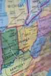
Covington is a city in Kenton County, Kentucky, United States, located at the confluence of the Ohio and Licking Rivers. Cincinnati, Ohio, lies to its immediate north across the Ohio and Newport, to its east across the Licking and Ludlow to its west. Covington had a population of 40,640 at the time of the 2010 U.S. census, making it the largest city of Northern Kentucky and the fifth-most populous city in the state. It is one of its county's two seats, along with Independence.
Covington photos